UK Location (INSPIRE)
Type of resources
Available actions
Topics
Keywords
Contact for the resource
Provided by
Years
Formats
Representation types
Update frequencies
Service types
Scale
Resolution
-
The Britrocks database provides an index to the BGS mineralogical & petrological collection. The computer database covers samples in the UK onshore mapping collection together with world wide reference minerals and the Museum Reserve collection. Currently circa 200k out of circa 300k samples are recorded in the computer database. A collection audit is ongoing, so availability of any particular sample is not guaranteed. The first England and Wales collection sample is from circa 1877, Threshthwaite Comb, Cumbria (collected by the Reverend Clifton Ward). The addition of new samples, transfer of records from registers and updates of existing records is ongoing on a regular basis. Internet access to the database is provided on the BGS web site.
-
Magnetograms are records of variations in the strength and direction of the Earth’s magnetic field. Historically these magnetograms were recorded on paper using photographic techniques. In the UK, measurements were made at eight long-running observatories; Abinger, Eskdalemuir, Falmouth, Greenwich, Hartland, Kew, Lerwick, and Stonyhurst. BGS also hold magnetogram records from the Cape Evans observatory that ran continuously at Robert Falcon Scott’s Antarctic base camp during the British Antarctic Expedition 1910–13. The magnetogram collection, one of the longest running geomagnetic series in the world, provides a continuous record of more than 160 years of UK measurements. These magnetograms start in the 1840s and end in 1986 at which time digital recording of the magnetic field took over and magnetograms can be produced by computer graphic. The plots show variation in the Earth's magnetic field, typically over a 24-hour period. The collection is a valuable, partly untapped data resource for studying geomagnetic storms, space weather and the evolution of the Earth’s magnetic field. The magnetograms provide insight into: • the Earth’s outer core: long-term change (years to centuries) in the dynamo that sustains our magnetic field • space weather: short-term changes (seconds to days) in near-Earth space and on the ground • space climate: long-term change (decades to centuries) in solar activity and consequences for Earth’s environment All the above have an impact on human activities. For example, bad space weather affects technologies that we increasingly rely on, such as electrical power and GPS networks. In response to the threat of loss from degradation due to age and a desire to preserve and exploit old data, BGS undertook a programme of work to digitally photograph, archive and preserve the analogue paper records of magnetic field variation in the United Kingdom. Between 2009 and 2013, high-quality digital images of every available magnetogram were taken. These images are available to search online. Scientists and the general public around the world can now gain easy access to this historical dataset.
-
Digital hourly mean values of the Geomagnetic field elements from Lerwick, Eskdalemuir, Abinger and Hartland Observatories. Eskdalemuir data are available from 1911, Lerwick from 1926, Hartland from 1957 and all three are available up to yesterday's date. Values from Abinger (1926-1956) are available on request. Most data are definitive, but recent data (within the last 203 years) are provisional and may be corrected in the future. Values of declination (D), horizontal intensity (H) and vertical intensity (Z) are available. The units of declination are degrees. Declination is negative when west of true north. The units of horizontal intensity and vertical intensity are nT (nanotesla). Vertical intensity is positive in the downwards direction. The data from these observatories will not only aid scientific research into rates of change of the magnetic field and increase the accuracy of the BGS Global Geomagnetic Model, but will also provide data to exploration geophysicists engaged in current and future oil exploration.
-
The K-index scale summarises geomagnetic activity at an observatory by assigning a code, an integer in the range 0 to 9 (0 being the least active field and 9 the most active field) to each 3-hour Universal Time (UT) interval. K-Indices are available for Lerwick, Eskdalemuir, Greenwich, Abinger and Hartland Magnetic Observatories. From 1954-90 the values are hand scaled, from 1991 to the present day they are automatically scaled. The data not only aids scientific research into rates of change of the magnetic field and increases the accuracy of the BGS Global Geomagnetic Model, but also provides data to exploration geophysicists engaged in current and future oil exploration.
-
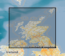
Miscellaneous geological records for Scotland and Northern England of current or semi-current interest filed in order of accession. Some 65 accessions held which will be subject to review for permanent retention/destruction. Dataset created c.1970 and Indexed on Land Survey Record Index Database.
-
Index to manuscript geological maps produced by the Survey geologists or other recognised geologists on County Series (1:10560) and National Grid (1:10560 & 1:10000) Ordnance Survey base maps. The index was set up in 1991. Current holdings for Great Britain are over 35,000. There are entries for all registered maps but the level of detail depends on nature of original Survey, ie not all fields are complete for all entries.
-
Registers of macrofossils in 127 volumes, covers the whole of the UK. Within each volume, data is arranged sequentially usually by collectors no. The data set began with the first Palaeontologist in the Geological Survey of Great Britain.
-
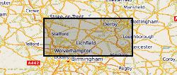
The full title of this project is" Studies into metal speciation and bioavailability to assist risk assessment and remediation of brownfield sites in urban areas" and is funded by NERC under the URGENT thematic programme form 1998-2001. The project is being undertaken by a consortium of workers from the Imperial College, University of Nottingham, and the British Geological Survey. Innovative collaborative and multi-disciplinary research will be applied to the interpretation of urban geochemical maps and associated meta-datasets to assist decision making by local authorities in the redevelopment of brownfield sites. Source apportionment, speciation and bioavailability of potentially toxic heavy metals will be studied at representative conurbations in the UK Midlands region. Scanning electron microscopy, chemical extractions and soil solution and vegetable analysis, will be integrated with high precision isotopic analyses of Pb and other potential toxic metals in this study. The results will be available as maps in GIS format to provide a generic decision support system for quantitative health risk assessment.
-
Data from projects that investigated the migration, transport and retardation processes of naturally occuring trace elements, as analogues the behaviour in the geosphere environment, of radionuclides from radioactive wastes. Study sites included: the Quaternary Broubster Peat Bog, near Thurso in Caithness (study of the migration behaviour and characteristics of U, Th, Ra, Pb, Cu, Zn, organic complexes such as fulvic and humic acids); the Needle's Eye site (Quaternary estuarine and marsh/mudflat sediments) on the Solway Coast of Dumfries and Galloway (study of the migration and retardation behaviour of U in Quaternary sediments and fractured Palaeozoic source rocks); Study of U geochemistry and transport behaviour from uranium-rich mine wastes at the South Terras Mine site, near St Austell, Cornwall; Study of the geochemistry of diffusion of Cl and I from marine source sediments into lacustrine sediments in Quaternary sediments from Loch Lomond. Data consists entirely of published reports of geological, geochemical, hydrochemical petrological and mineralogical information. The data includes descriptive and numerical data but is not digitally available in its present state.
-
The Geophysical Properties dataset consists of density, velocity, magnetic susceptibility and thermal conductivity values, with related source, location and geology data. The data have been collected on a project basis, therefore the quality and completeness of the database coding is variable. The data is currently from the UK and Ireland although this may be extended. The data consists of samples with related data values - (1,000s), Density Values - Laboratory Measurements - (1,000s); Velocity Values - Laboratory Measurements - (1,000's), Magnetic Susceptibility Values - Laboratory Measurements - (1,000s); Magnetic Susceptibility Values - Field Measurements - (10,000s measurements on 1,000s samples). Borehole information for data obtained as Downhole profiles with related data values; British Rock Densities Project - Insitu density values obtained from the analysis of formation density logs - (10s boreholes with 100s values). Downhole Magnetic Susceptibility - Obtained for a confidential project with some offshore - (10s boreholes with 10,000s samples) . Thermal Conductivity - (100s boreholes with 1,000s samples), Mean Data Values derived from a data source such as published literature for a site or rock formation; Density - (100s), Magnetic Susceptibility - (100s). Information about the source from which data is obtained, Engineering Geology Laboratory Reports - (100s), Literature which may be published or unpublished - (100s). The database is not maintained and no new data has been added since 2004.
 BGS Data Catalogue